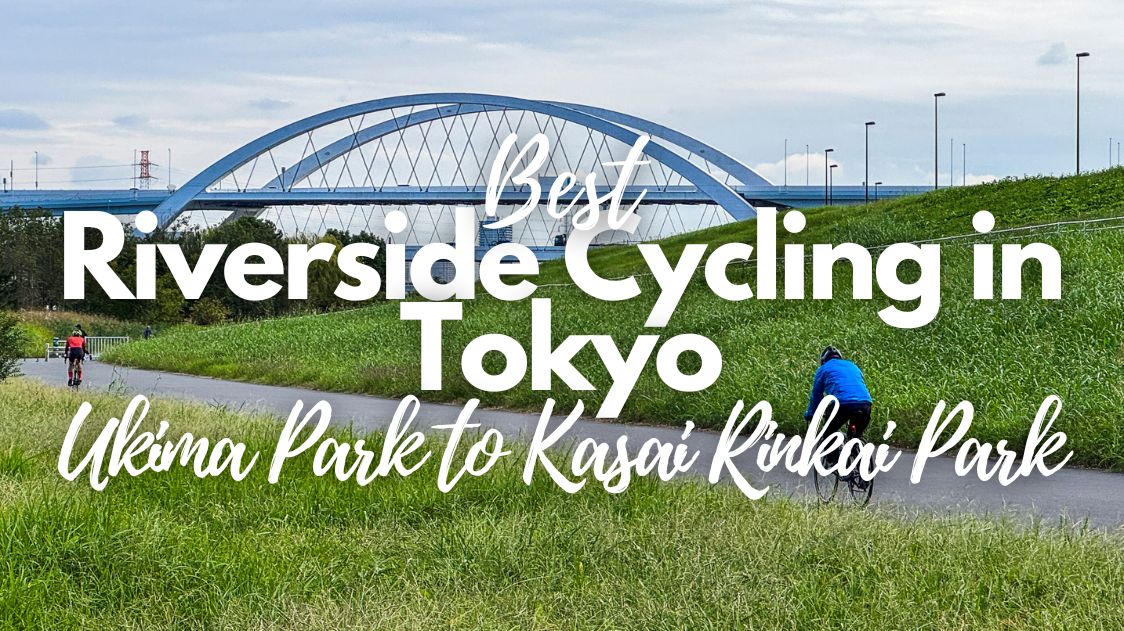
Best Riverside Cycling in Tokyo: Ukima Park to Kasai Rinkai Park Ride
Arakawa River Cycling Route: A Scenic Tokyo Ride

- +0 0
-

-


Tokyo often carries a reputation abroad as an endless expanse of concrete and neon. Stand in the middle of districts like Shinjuku Station or Shibuya Crossing, and it is easy to understand where that image comes from. Yet the city also hides vast open spaces that rarely appear on typical travel itineraries.
One of the most surprising ways to discover that side of the capital is by cycling along the banks of the Arakawa, or Ara River. This massive river corridor cuts across eastern Tokyo, bordered by long levees, sports fields, and riverside parks. The terrain is completely flat, the paths run for kilometers without traffic, and the skyline often gives way to wide skies and grassy floodplains.
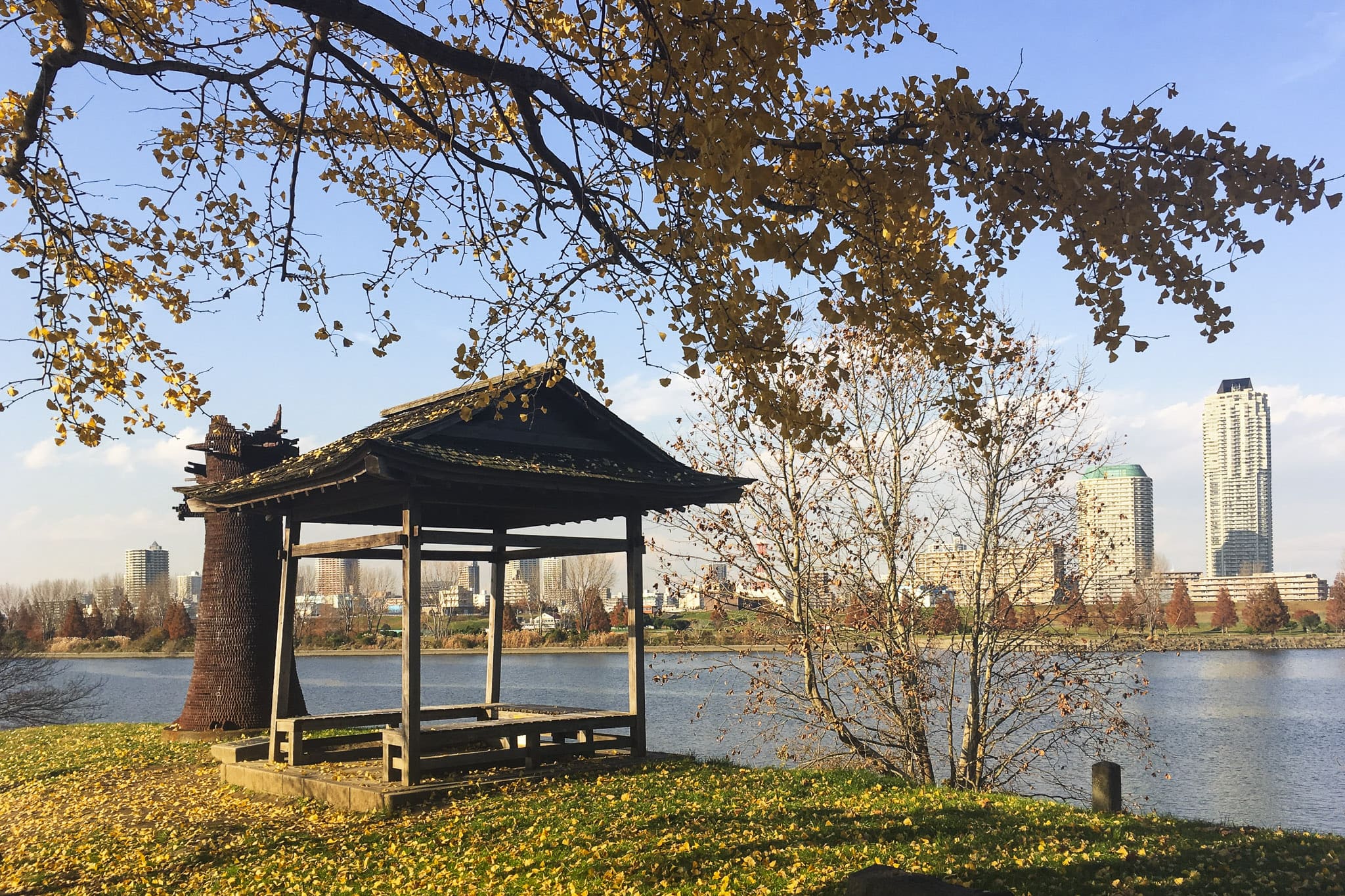
I started cycling around the area when I used to live in Itabashi Ward. A particularly enjoyable section runs from Ukima Park in the north to the waterfront at Kasai Rinkai Park. The ride covers roughly 30 kilometers, following the river steadily downstream until it reaches Tokyo Bay. Along the way, the route passes historic floodgates, quiet riverside parks, and unexpected picnic spots, with plenty of opportunities to stop and take in the scenery.
It is a route I like to return to from time to time, sometimes riding the full distance and sometimes just a short stretch. Either way, the experience always offers the same reminder: Tokyo is not only a city of dense neighborhoods and crowded stations. Follow the Arakawa long enough, and you will discover an entirely different landscape running quietly through the metropolis.
Why the Arakawa Is One of the Best Cycling Routes in Tokyo
Among cyclists living in Tokyo, the paths along the Ara River, or Arakawa (荒川), have long been a favorite training ground. The reasons became obvious since the first time I discovered this route.
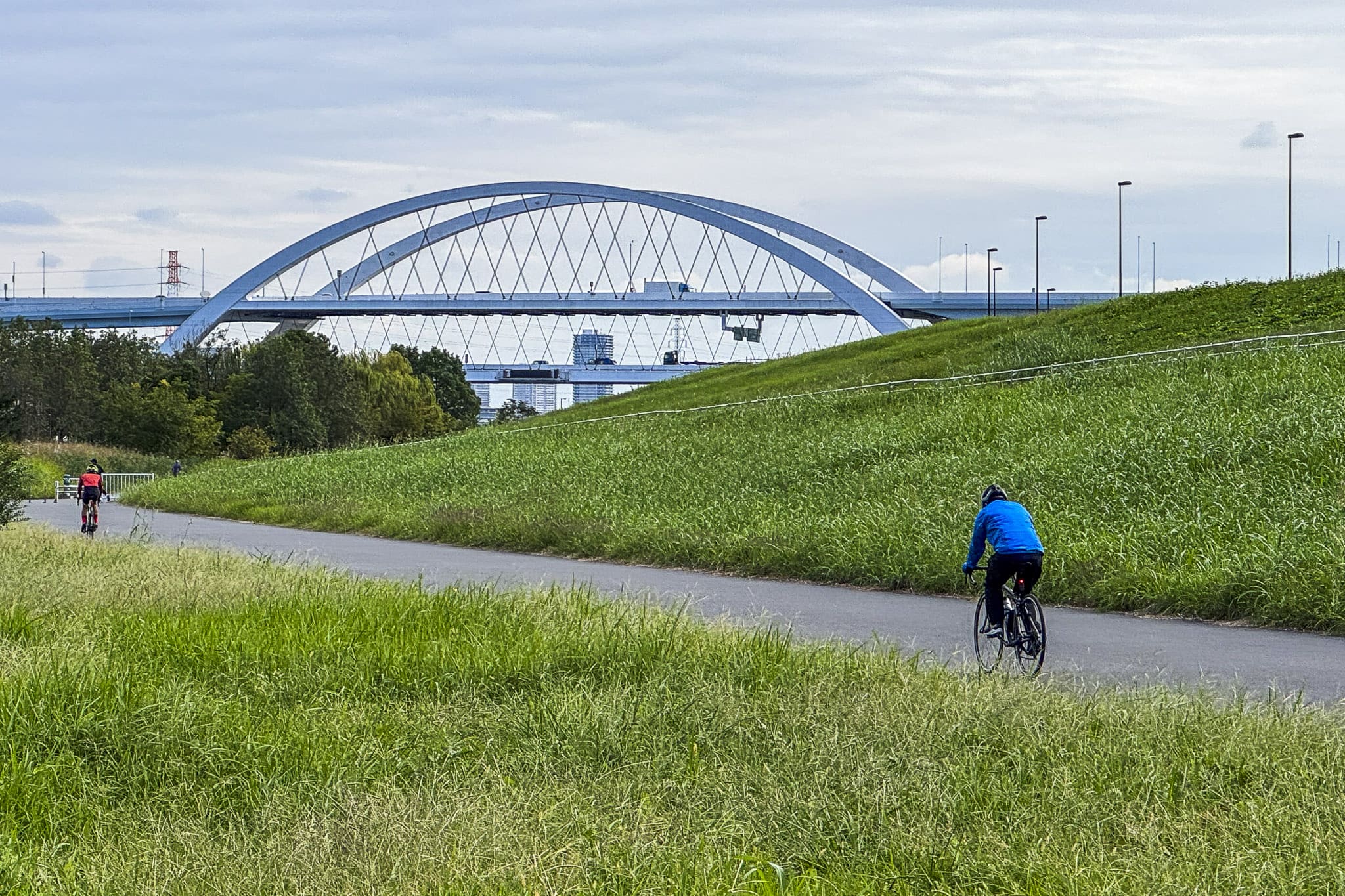
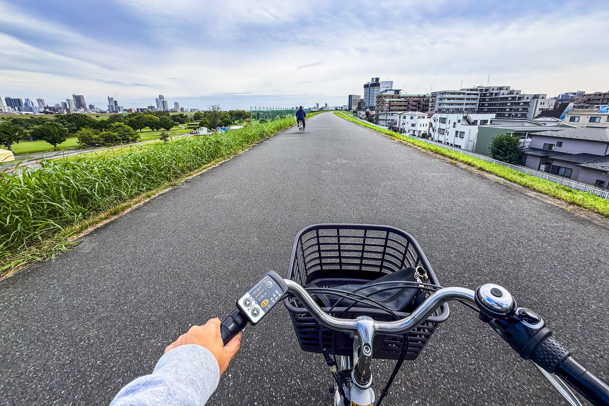
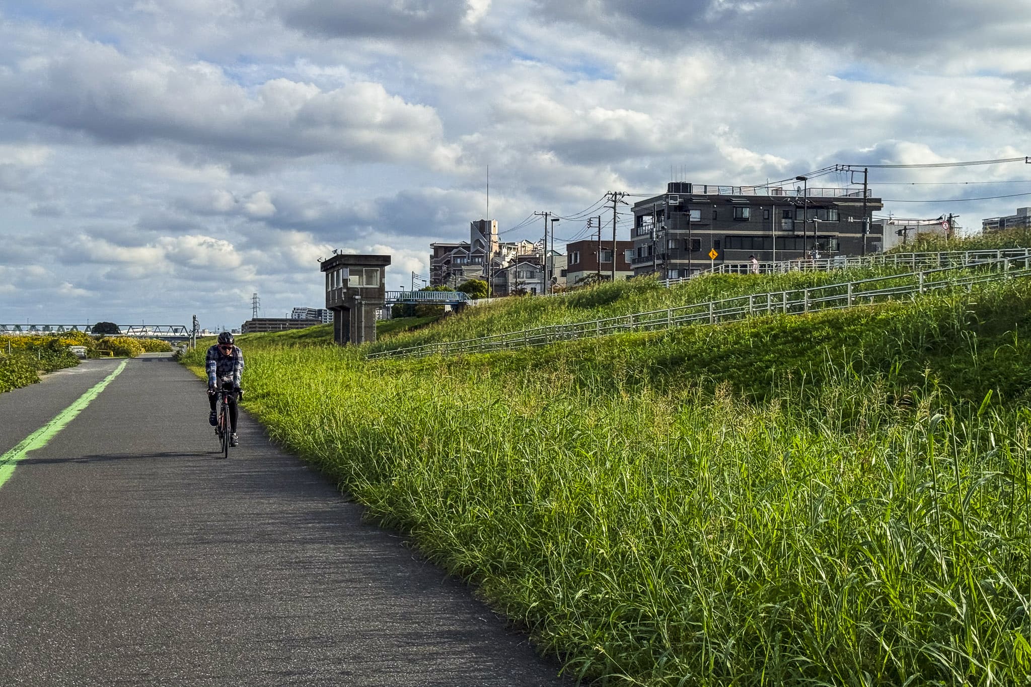
Unlike most urban cycling routes, the levee roads beside the river run for long stretches without traffic lights or intersections. Once you reach the top of the embankment, the path continues almost uninterrupted for kilometers, shared mainly with joggers, walkers, and other cyclists. The terrain is completely flat, which makes the route accessible to riders of almost any level.
Much of this open space exists thanks to Tokyo’s flood-control infrastructure. During the twentieth century, engineers reshaped the Arakawa to protect the eastern districts of the city from flooding. The resulting levees created a broad floodplain lined with parks, sports fields, and recreation areas rather than dense construction.
As a result, the river corridor forms a surprisingly large green belt cutting across several wards, including Kita, Adachi, Katsushika, and Edogawa. Baseball diamonds, soccer fields, and grassy embankments stretch along the banks, while bridges and passing trains provide a constant reminder that you are still riding through one of the world’s largest cities.
Arakawa Cycling Route Overview
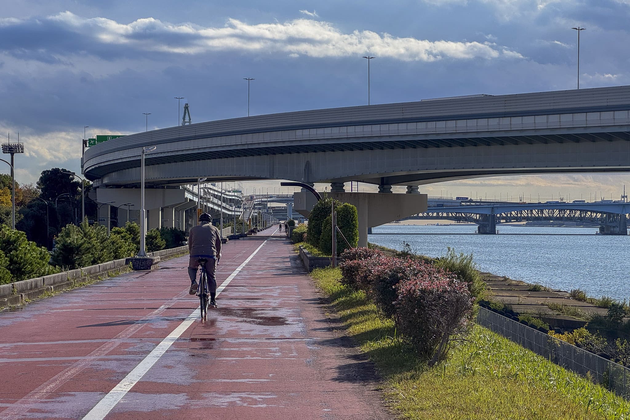
The ride from Ukima Park to Kasai Rinkai Park follows the banks of the Arakawa for roughly 30 kilometers. Thanks to the levee paths running along both sides of the river, the route is straightforward and easy to follow: once you reach the top of the embankment, you simply continue downstream. Few urban bike rides offer the simple satisfaction of traveling all the way from inland Tokyo to the edge of Tokyo Bay.
In terms of difficulty, this is one of the most accessible cycling routes in Tokyo. The terrain is completely flat, with no meaningful elevation changes along the way. Many riders complete the journey in two to three hours at a relaxed pace, although my personal take (and the one I want to encourage) consists of taking my time and stopping at several riverside parks along the route.
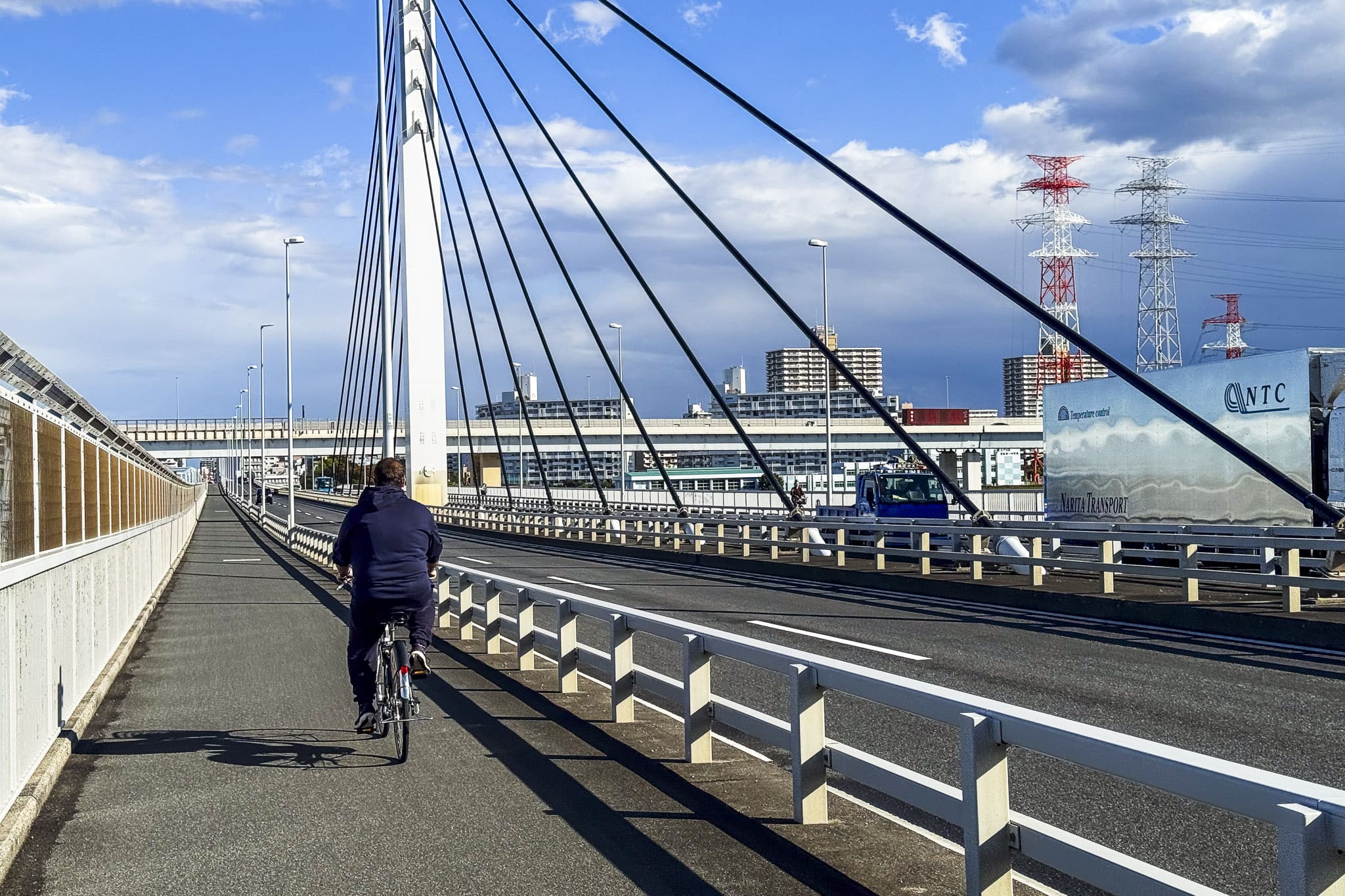
Navigation is also refreshingly simple compared with typical city cycling. Because the levee paths run parallel to the river, there are very few intersections with car traffic. The ride becomes a steady rhythm of pedaling past sports fields, grassy embankments, and the occasional bridge crossing overhead.
About Using Bike Sharing for This Ride
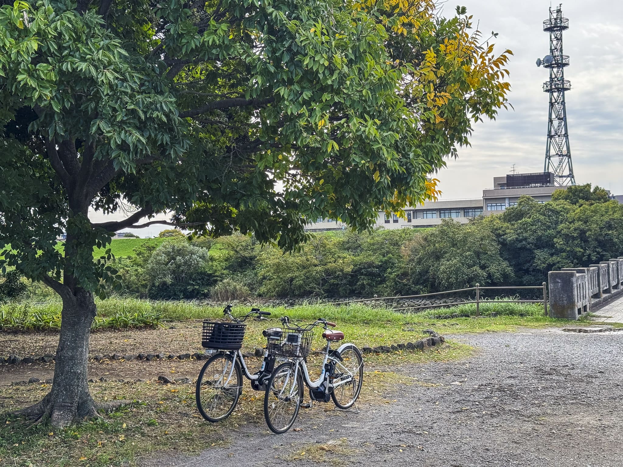
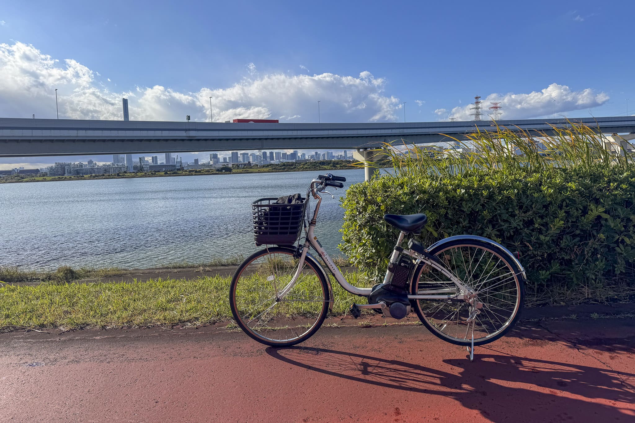
One practical way to tackle this route is by using one of Tokyo’s bike-sharing services. I usually rely on HELLO CYCLING, which operates a large network of rental bikes across the city. After registering through the mobile app, you can locate nearby stations on a map, unlock a bicycle with your phone, and return it at any other station within the same network. The bikes are typically electric-assist models, which makes longer rides along the river course at the Arakawa much easier. Prices start around 160 yen for the first 30 minutes, up to 2,500 yen for 12 hours.
For this particular ride, the system works quite well: there are HELLO CYCLING stations near both Ukima Park and Kasai Rinkai Park, so you can pick up a bike at the northern end of the route and return it once you reach Tokyo Bay. From there, it’s a short walk to Kasai-Rinkai Park Station on the JR Keiyō Line, making it easy to head back into central Tokyo without riding the entire distance again. For a relaxed day outdoors, that combination of a long riverside ride and an easy train connection makes the Arakawa route particularly appealing.
Starting the Ride at Ukima Park


The ride begins at Ukima Park (浮間公園), a relaxed riverside park in northern Tokyo. The nearest station is Ukimafunado Station on the JR Saikyo Line, placing the starting point within easy reach of major hubs like Ikebukuro Station and Shinjuku Station.
The park itself surrounds Ukima Pond, a calm body of water that was once part of the Arakawa River before flood-control works reshaped the area in the twentieth century. Today the pond forms the centerpiece of the park, with walking paths, benches, and seasonal flowers around its edge. One of the most recognizable features is the Dutch-style windmill standing beside the water, which has become a small local landmark.
It’s a pleasant place to take a few minutes before setting off. Joggers circle the pond, anglers occasionally line the banks, and during spring the surrounding paths fill with cherry blossoms. Practical amenities such as restrooms and nearby convenience stores also make it an easy place to prepare for a longer ride.
From here, reaching the cycling path is simple. The river levee of the Arakawa rises just beyond the park. Once you climb onto the embankment, the city suddenly opens into a wide riverside landscape, and the path heading south begins the gradual journey downstream toward Tokyo Bay.
 Access Access |
1-min walk from Ukimafunado Station |
|---|---|
 Official Website Official Website |
https://www.tokyo-park.or.jp/park/format/index009.html |
Picnic Stop at Nakanoshima and the Old Iwabuchi Water Gate


A short ride south from Ukima Park brings you to one of the most distinctive landmarks along the upper Arakawa River: the historic Old Iwabuchi Water Gate (旧:岩淵水門). Often called the Akamizumon (Red Water Gate 赤水門), this striking red structure has regulated water flowing between the Arakawa River and the Sumida River since the 1920s, playing a crucial role in Tokyo’s flood-control system.
Next to the original gate stands the newer Iwabuchi Watergate ( 岩淵水門), built in the 1980s and now popularly known as Aomizumon, or Blue Watergate (青水門), but the older red structure remains a well-loved local landmark. The contrast between the two gates is easy to spot from the cycling path, and it marks the point where the river begins to feel dramatically wider.
Just beside the gate lies a small island known as Nakanoshima (中之島), part of Arakawa Akamizumon Green Space (荒川赤水門緑地). A short pedestrian bridge leads across to this patch of greenery sitting between the river channels. Compared with the open levees around it, the island feels surprisingly intimate.
It’s one of my favorite places to pause along the ride. The grassy space and benches make it ideal for a quick picnic, while the surrounding water gives the spot a calm atmosphere despite being only a short distance from central Tokyo. From here, you can watch cyclists passing along the levee above, fishing lines stretching into the river, and the occasional boat moving slowly through the channel.
Riding the Wide Levees of Adachi Ward
Continuing south from the Iwabuchi Water Gate, the cycling path enters the long riverbanks of Adachi. This stretch captures the character of the Arakawa River at its most expansive.
From the top of the levee, the landscape opens into a broad floodplain that seems almost out of place within Tokyo. Instead of dense neighborhoods pressing against the river, wide grassy fields extend in both directions.
Relaxing at Shinden Wakuwaku Waterside Field


One pleasant place to pause along this stretch is Shinden Wakuwaku Waterside Field, a riverside park in Adachi designed as a family-friendly recreation area along the Arakawa River. Large lawns spread out beside the river, with walking paths and benches scattered around the edges. One detail I particularly appreciate here is the presence of several weeping willow trees that provide a pleasant shade, especially during the warmer months, so sitting beneath one of these trees for a few minutes makes for a welcome break in the ride.
The Fireworks Fields Around Rainbow Plaza
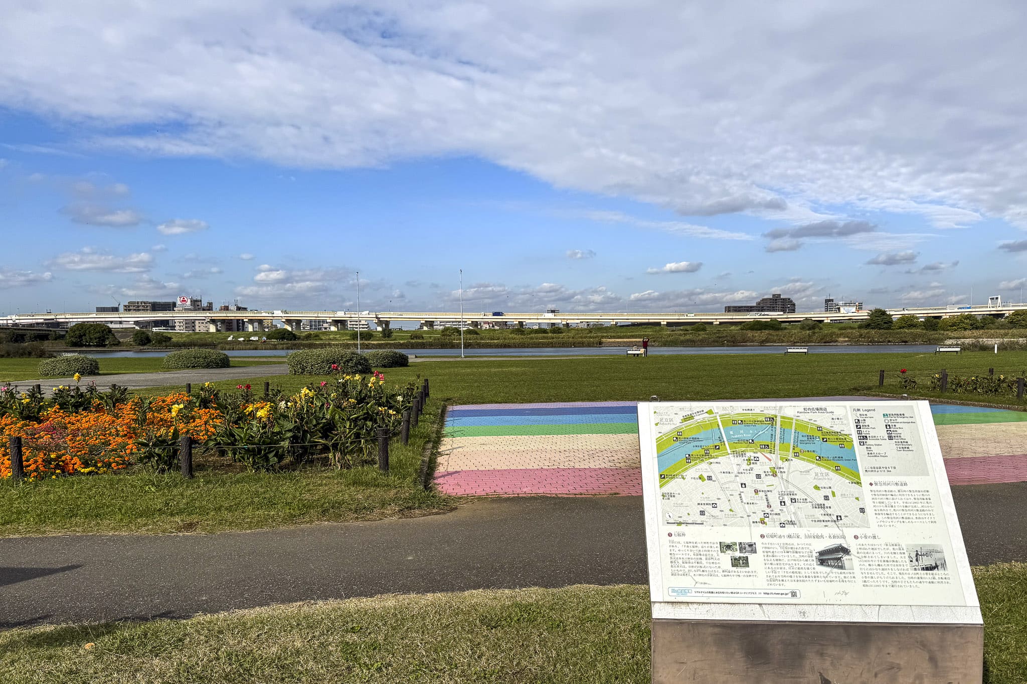
Further along the levee, the cycling path passes Rainbow Plaza, an open riverside area in Itabashi. On most days, it appears to be just another quiet section of the riverbank with wide grassy fields, walking paths and plenty of open sky above the Arakawa River. The only identifying trait is the rainbow-colored stairs on the levee.
However, this is a significant spot during the summer. The surrounding levees serve as one of the main viewing areas for the Itabashi Fireworks Festival, a major annual event that lights up the river with thousands of fireworks. Compared with the famously crowded Sumida River Fireworks Festival, the atmosphere here tends to feel slightly more manageable, even though the show itself is just as impressive. Outside the festival season, however, Rainbow Plaza returns to its usual calm—a quiet expanse of riverside lawn where cyclists glide past on their way toward the lower reaches of the Arakawa.
Optional Detour: Tower Hall Funabori Observation Deck


For cyclists interested in seeing the river corridor and surrounding areas from above, a worthwhile detour leads to Tower Hall Funabori (タワーホール船堀) in Edogawa. The complex sits a few blocks east of the Arakawa, so it only requires leaving the river levee briefly.
The building serves as a civic center for Edogawa Ward, hosting event halls, meeting rooms, and cultural facilities. What drew me here, however, is the tower rising above the structure. At about 115 meters tall, it stands prominently above the surrounding low-rise neighborhoods. And best of all: the observation deck is free to access! An elevator takes you to the top, where large windows offer wide views across eastern Tokyo.
On clear days, the view stretches remarkably far. The skyline of central Tokyo rises in the distance, and in clear days of winter, you’re supposed to be able to spot Mount Fuji sometimes on the horizon. In any case, it’s always nice to get a chance to see the landscape from above, which adds a different perspective to the journey.
| Access |
2-min walk from Funabori Station |
|---|---|
 Business Hours Business Hours |
9 AM–9:30 PM |
 Price Price |
Free |
| Official Website |
https://www.towerhall.jp/ |
Reaching Tokyo Bay at Kasai Rinkai Park
After following the Arakawa steadily downstream for nearly 30 kilometers, the cycling path finally reaches the waterfront at Kasai Rinkai Park (葛西臨海公園) in Edogawa. The park forms a natural conclusion to the ride, marking the point where the river meets the open waters of Tokyo Bay.
Even before entering the park, one landmark is impossible to miss: the towering Diamond and Flower Ferris Wheel (ダイヤと花の大観覧車), one of the largest Ferris wheels in Japan. Its bright structure rises above the surrounding trees and lawns, acting as a clear visual signal that the coast is close.


Kasai Rinkai Park itself covers a large stretch of reclaimed land along the bay. Wide lawns and walking paths spread out across the waterfront, offering unobstructed views over the water. After riding through the long river corridor of eastern Tokyo, arriving here carries a quiet sense of completion: the river that began far inland now opens into the bay, and the skyline of the city fades into the distance behind you.
It’s a pleasant place to slow down, park (or return) the bike, and enjoy the sea breeze before heading back into the city.
Visiting Tokyo Sea Life Park
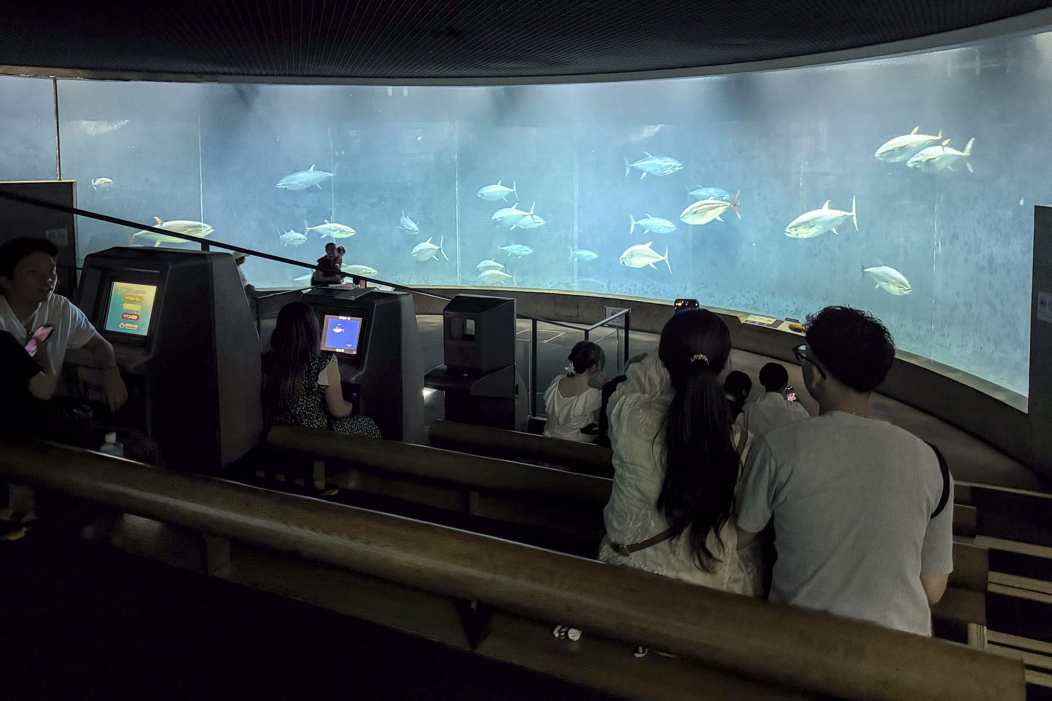
One of the main attractions within the park is Tokyo Sea Life Park (葛西臨海水族園), a well-known aquarium that focuses on marine ecosystems from around the Pacific. This is a large facility, and visiting it properly will probably require at least one or two hours, so depending on your timing, it may work as a final activity before returning to the city or as a reason to come back another day. If you enjoy aquariums, you should definitely check it out, as this is one of my favorite aquariums in Tokyo.


The building is immediately recognizable thanks to its large glass dome, which serves as the entrance pavilion. Inside, the exhibits revolve around a series of massive tanks showcasing ocean life from different regions. The most famous display features a large circular tank filled with schooling Pacific bluefin tuna, which swim continuously in a dramatic open-water exhibit. Although my favorite area is actually outside, a lively penguin enclosure where these cute birds swim and dive in pools facing the bay. Be on the lookout if the staff goes to feed them for an extra source of cuteness!
| Access |
4-min walk from Kasai-Rinkai Park Station |
|---|---|
| Business Hours |
9:30 AM–5 PM |
 Closed Closed |
Wednesday |
| Price |
700 yen |
| Official Website |
http://www.tokyo-zoo.net/zoo/kasai/ |
Crystal View and the Tokyo Bay Waterfront


A short walk through the park leads to Crystal View Rest House, a distinctive glass building overlooking the water.
The structure was designed as a viewing facility, with transparent walls that open toward the horizon. From its elevated viewpoints, you can look out across Tokyo Bay as cargo ships and ferries pass through the busy shipping lanes.
After the long ride along the riverbanks, the shift from freshwater to open sea becomes unmistakable here. The air carries the smell of salt, seabirds circle overhead, and the wide expanse of water contrasts sharply with the narrow river corridor you followed earlier in the day.
Walking Out to Kasai Marine Park


Just offshore from Kasai Rinkai Park lies Kasai Marine Park (葛西海浜公園), a coastal nature area consisting of artificial islands created to restore tidal flats in Tokyo Bay.
A long pedestrian bridge connects the mainland park to these islands, making it easy to continue exploring on foot after finishing the ride. The islands feature sandy beach areas and protected wetlands that attract migratory birds throughout the year. It’s a rather nice spot to see the sunset, dip your feet in the sea, or just relax looking at the landscape.
Practical Cycling Tips
A few practical considerations to make the ride more enjoyable:
- Best seasons: Spring and autumn are generally the most comfortable times to ride. Temperatures are mild, and the open levees provide clear views across the riverbanks.
- Summer heat: The levee paths offer very little shade. During Tokyo’s humid summers, the sun can feel intense for long stretches. Bringing plenty of water and sun protection is essential.
- Wind conditions: Because the route heads toward Tokyo Bay, don’t be surprised if you encounter headwinds closer to the coast, which may happen occasionally. The wind can become surprisingly strong on exposed sections of the levee.
- Shared path etiquette: The cycling route is shared with runners, walkers, and families enjoying the riverside parks, as well as seasoned cyclists. Be mindful of the space, slow down when passing others, or make sure you’re not blocking the road (if you’re riding with friends, for example) for other riders who may be going faster.
- Bring supplies: Convenience stores or vending machines are usually a short ride away from the riverbanks, but it is still wise to carry water, sunscreen, and a small snack for the journey.
Cycling along the Arakawa reveals a version of Tokyo that many visitors never encounter, which is why I like it so much. Instead of crowded streets and towering buildings, the route follows a wide corridor of open sky, grassy embankments, and riverside parks stretching across the eastern side of the city.
Combining it with a bike share service, this route allows a lot of flexibility. As I said at the beginning, sometimes I complete it in a single ride, sometimes I just ride for shorter sections along the river whenever I want a break on a nice clear day. With so many bike sharing stations scattered all over, it’s easy to decide on a whim anytime. Either way, the experience highlights how much green space surrounds the Arakawa River, creating a long recreational corridor through one of the world’s largest metropolitan areas.
Read more from my recent travel stories and guides:


For more information about nearby things to do, check these articles too:

Written by
Photographer, journalist, and avid urban cyclist, making sense of Japan since 2017. I was born in Caracas and lived for 14 years in Barcelona before moving to Tokyo. Currently working towards my goal of visiting every prefecture in Japan, I hope to share with readers the everlasting joy of discovery and the neverending urge to keep exploring.
- +0 0
-
-